Coastal Navigation
Coastal Navigation: Advanced Cruising Techniques - ASA Course 105

Register for Coastal Navigation Starpath Online or Northern Breezes Independent Study
Register for Coastal Navigation Classroom Course
Classroom Location
Sailcrafters, 7450 Oxford Street, St. Louis Park, MN 55426
Description
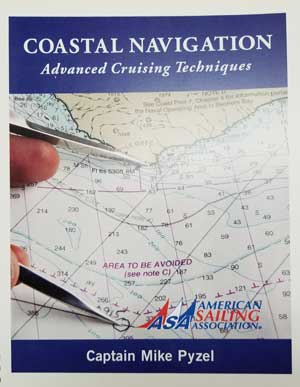
We use the official American Sailing Association (ASA) textbook and accompanying PowerPoint edited by Captain Thom Burns, Northern Breezes. Thom does seminars on the subject at both the Strictly Sail, Chicago and the Minneapolis Boat Shows.
Learn the navigational theory and practical skills required to safely pilot a sailing vessel in coastal or inland waters. Learn how to take this solid foundation and integrate it into sensible, practical applications of GPS usage. This is a tool which is directly responsible for up to 25% of all groundings according to the Boat U.S. Seaworthy Magazine, which compiles data from the boating insurance industry. Students progress from dead reckoning to more complex piloting while incorporating tides, current, leeway, GPS and a brush of radar. This is a fun learning experience with ASA certification!
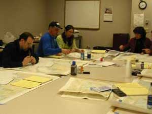
The evening course meets four times and allows plenty of weekend chart/problem time. The Saturday course meets two times. Both classes require dedicated practice time in order to get the most out of the class. "The key to success is doing problems!"

Course Outline for Evening Class
Day 1: NAVIGATION, PILOTING AND CHARTS. Measuring direction and distance; utilizing the compass rose. READING NAUTICAL CHARTS. Chart symbols: Buoys, beacons, lights, soundings and danger symbols. DEAD RECKONING NAVIGATION. Measuring and plotting direction and distance, bearings and courses; speed-time-distance calculations, tacking upwind. BEARINGS AND FIXES. Using hand bearing compasses; plotting more bearings, use of soundings, deriving an estimated position, dipping a light, bow/stern versus beam bearings. BASIC GPS INTEGRATION.
Day 2: CORRECTING YOUR COURSE FOR CURRENT AND LEEWAY. Course, heading and track; determining set and drift of current; measuring leeway. TIDES AND TIDAL CURRENTS. Causes of tides and currents; using tables to predict height of tide, and set and drift of current; tidal current charts; visual indicators of current; shoaling effect; counter currents, insetting effect. FOG NAVIGATION. DR in fog; depth meter navigation; bearings in fog; Polynesian concepts and visual observations; surviving with shipping; Currents in fog. MORE GPS INTEGRATION.
Day 3: RULES OF THE ROAD. Right of way; avoiding close calls; skipper responsibilities; lights and Dayshapes; sound signals. GPS waypoints and routes, cross track errors, hierarchy of software commands. Introduction to RADAR. REVIEW AND FUN PROBLEMS. Transiting problems on Lake Superior from the Apostle Islands.
Day 4: Final Review items then EXAMINATION. Written exam cements independent navigational thinking and completes ASA requirements for Coastal Navigation certification.
Course Outline for Saturday Class
Day 1: NAVIGATION, PILOTING AND CHARTS. Measuring direction and distance; utilizing the compass rose. READING NAUTICAL CHARTS. Chart symbols: Buoys, beacons, lights, soundings and danger symbols. DEAD RECKONING NAVIGATION. Measuring and plotting direction and distance, bearings and courses; speed-time-distance calculations, tacking upwind. BEARINGS AND FIXES. Using hand bearing compasses; plotting more bearings, use of soundings, deriving an estimated position, dipping a light, bow/stern versus beam bearings. CORRECTING YOUR COURSE FOR CURRENT AND LEEWAY. Course, heading and track; determining set and drift of current; measuring leeway. BASIC GPS INTEGRATION. TIDES AND TIDAL CURRENTS. Causes of tides and currents; using tables to predict height of tide, and set and drift of current; tidal current charts; visual indicators of current; shoaling effect; counter currents, insetting effect. FOG NAVIGATION. DR in fog; depth meter navigation; bearings in fog; Polynesian concepts and visual observations; surviving with shipping; Currents in fog. Introduction to RADAR. More GPS INTEGRATION. Transiting problems on Lake Superior from the Apostle Islands.
Day 2: RULES OF THE ROAD. Right of way; avoiding close calls; skipper responsibilities; lights and day shapes; sound signals. ELECTRONIC NAVIGATION. GPS waypoints and routes, cross track errors, hierarchy of software commands. REVIEW AND EXAMINATION. Written exam cements independent navigational thinking and completes ASA requirements for Coastal Navigation certification.

Northern Breezes' Starpath Online Course
This is a great option for students unable to attend our regular classroom course. The Starpath Coastal Navigation Online Course covers everything we cover in the classroom course, along with giving students access to a vast number of practice questions and quizzes and online resources.
With this combination you can choose the media that is most convenient to you at the time. Use the search engines and software resources from the computer, while you work through the lessons, assignments and quizzes in the interactive online classroom. And when you are away from the computer, study with the printed texts, and paper chart.
Most important, however, with this versatile package you can learn both traditional and electronic navigation at the same time—solve the practice problems in the traditional manner on a paper chart with standard plotting tools and also solve the problems electronically in an echart program using waypoints, bearing lines, and range rings.
Why take the Coastal Navigation Online Course through Northern Breezes and not directly from Starpath?
| Northern Breezes | Starpath |
| $329.00 for course, materials, and no shipping cost.* $30.00 for test with no charge for ASA certification.*Orders are priced for shipping to USA customers. |
$349.00 for course $30.00 for test $29.00 for ASA certification Plus shipping cost |

Northern Breezes' Independent Study Class / Correspondence
This course has been successfully completed by several students who are remotely located. It usually requires some time spent with a navigation instructor by email or telephone. Cost is $179 for the correspondence course comes with the same materials used in the classroom course: book/study problems, and chart. The fee includes ASA certification. Note: this course is not online.
Course Fee for Coastal Navigation
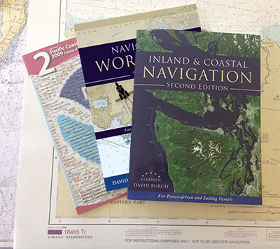
Classroom Course: $279, including course materials: Navigation Textbook and practice chart; and ASA certification upon successful completion. $35 discount for couples sharing materials (any two people signing up together).
Starpath Online Course: $329, including materials.
Add $30 for exam and free ASA certification upon successful completion of Starpath Online Course.
Required Tools
A set of Parallel Rules and Dividers are required for this course. The Compact ParaLock Plotter will also work as Parallel Rules.
We sell Weems & Plath tools with the course at a better price than West Marine. They are suitable for chart books. Additional tools, items and books are available for purchase and are brought to class for your perusal.
Available for purchase
Navigation instruments by Weems & Plath.
12" Parallel Rules: $20.00 - or - 7" Compact ParaLock Plotter $25.00*
Ultra light 7" dividers: $19.00
Nautical Slide Rule: $19.00
Chart Protractor: $22.00
Chart No. 1: $25.00
Coast Guard Navigation Rules: $13.00
*Both instruments are ideal for chart books. They are lifelong instruments.
Note: No sales tax when purchased with the class. Extra shipping charge is required for tools purchased with Starpath Online courses.
CLASS SCHEDULE for Coastal Navigation Classroom Course
Classroom Course is not currently offered. Choose Northern Breezes Independent Study Course or Starpath Online Course.
(Dates are subject to change)
N1: Saturdays 9am-4pm, with lunch break:
Dates to be determined
7-hour Saturday sessions 9am-4pm
This is an intense class due to the two Saturdays of seven hours per day. Please allow time for study and practice problems in addition to our normal in-class problems.
N2: Tuesdays 6-9pm:
Dates to be determined
3-hour evening sessions 6-9pm (or as close as possible)
Directions to Sailcrafters
7450 Oxford Street, St. Louis Park, MN 55426
From Hwy 169
Take exit for Hwy 7 East
Hwy 7 east to Louisiana Ave S
At the traffic circle, take the 2nd exit onto Louisiana Ave S
Turn right onto Oxford St, Sailcrafters will be on the right
From Hwy 100
Take exit for Hwy 7 West
Hwy 7 west to Louisiana Ave S
Turn right onto Louisiana Ave S, make a U-turn
At the traffic circle, take the 2nd exit and stay on Louisiana Ave S
Turn right onto Oxford St, Sailcrafters will be on the right.
Prerequisite for this course
None.
This course along with Basic Cruising-ASA 103 and Bareboat Charter Certification-ASA 104 are prerequisites for Advanced Coastal Cruising-ASA 106 (long offshore passages).
Call Northern Breezes Sailing School at 763-542-9707 to register or with questions.
Register for Coastal Navigation Starpath Online or Northern Breezes Independent Study
Register for Coastal Navigation Classroom Course
